

SvalMIZ26: Student reflections on the importance of field campaigns for advancing polar predictions
The Svalbard Marginal Ice Zone 2026 Campaign has recently concluded (10 - 19 April 2026) with the successful deployment of 18 OpenMetBuoys continuously measuring wave activity, temperature profiles and sea ice drift. For this year’s iteration of the SvalMIZ campaign, two students from the Norwegian Meteorological Institute (Alessio Canclini and Are Frode Kvanum) joined Dr. Malte Müller and Dr. Jean Rabault Førland on their expedition into the vast Arctic Ocean. Alessio Canclini and Are Frode Kvanum reflect on their experience conducting fieldwork close to 84 degrees North.
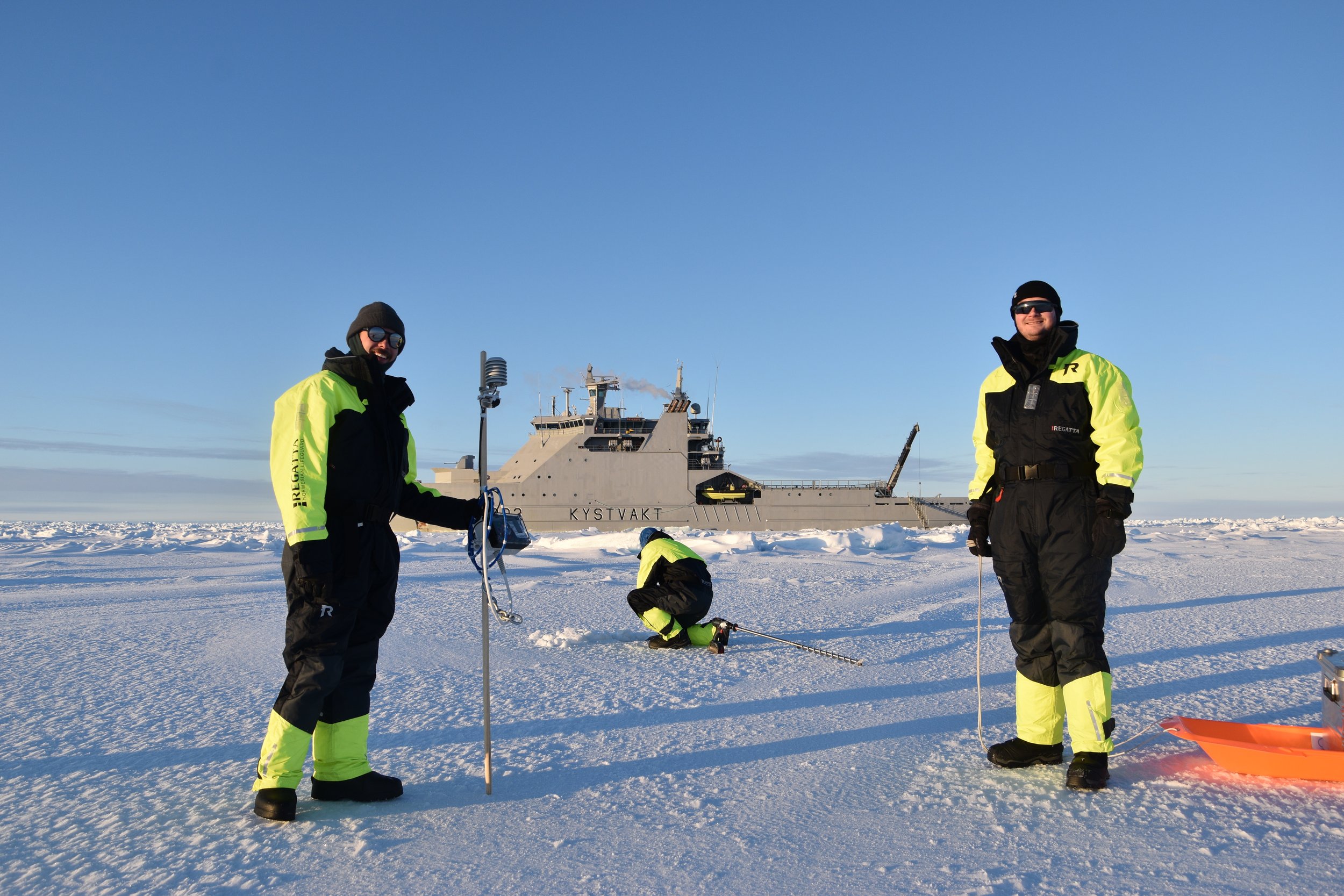
Alessio and Are preparing a buoy for deployment, with Jean drilling a hole for the temperature profile string. The icebreaker KV Svalbard can be seen in the background. Photo credit: Malte Müller
With the rapid decline of Arctic sea ice expediting users' interest in the Arctic, understanding the Marginal Ice Zone's dynamics remains a key challenge to improve Arctic prediction systems. The SvalMIZ Campaign-series directly addresses the need for knowledge of MIZ dynamics by providing in-situ measurements in an otherwise under-sampled sea ice regime. This year, a total of 18 OpenMetBuoys were deployed north of Svalbard, forming an observational grid of air- and surface temperature including an ice/ocean temperature profile. Additional wave-in-ice interactions and sea-ice drift measurements are also being carried out, all of which are available as an open source dataset.
The SvalMIZ cruise presented an opportunity to directly observe sea ice at local scales. Compared to sea ice models, which usually represents sea ice as a smooth homogenous cover due to resolving at kilometre scales, the sea ice we encountered in the field consisted of a multitude of individual floes exerting complex interactions, local fracturing and strongly varying thickness. As someone studying sea ice, this first hand encounter has provided insight into the important role spatial scales play in deciding how the sea ice will behave and should best be represented. Additionally, having first hand experience with local-scale sea ice dynamics will prove useful as we continue to work towards increasing the spatial resolution of our sea ice model systems.
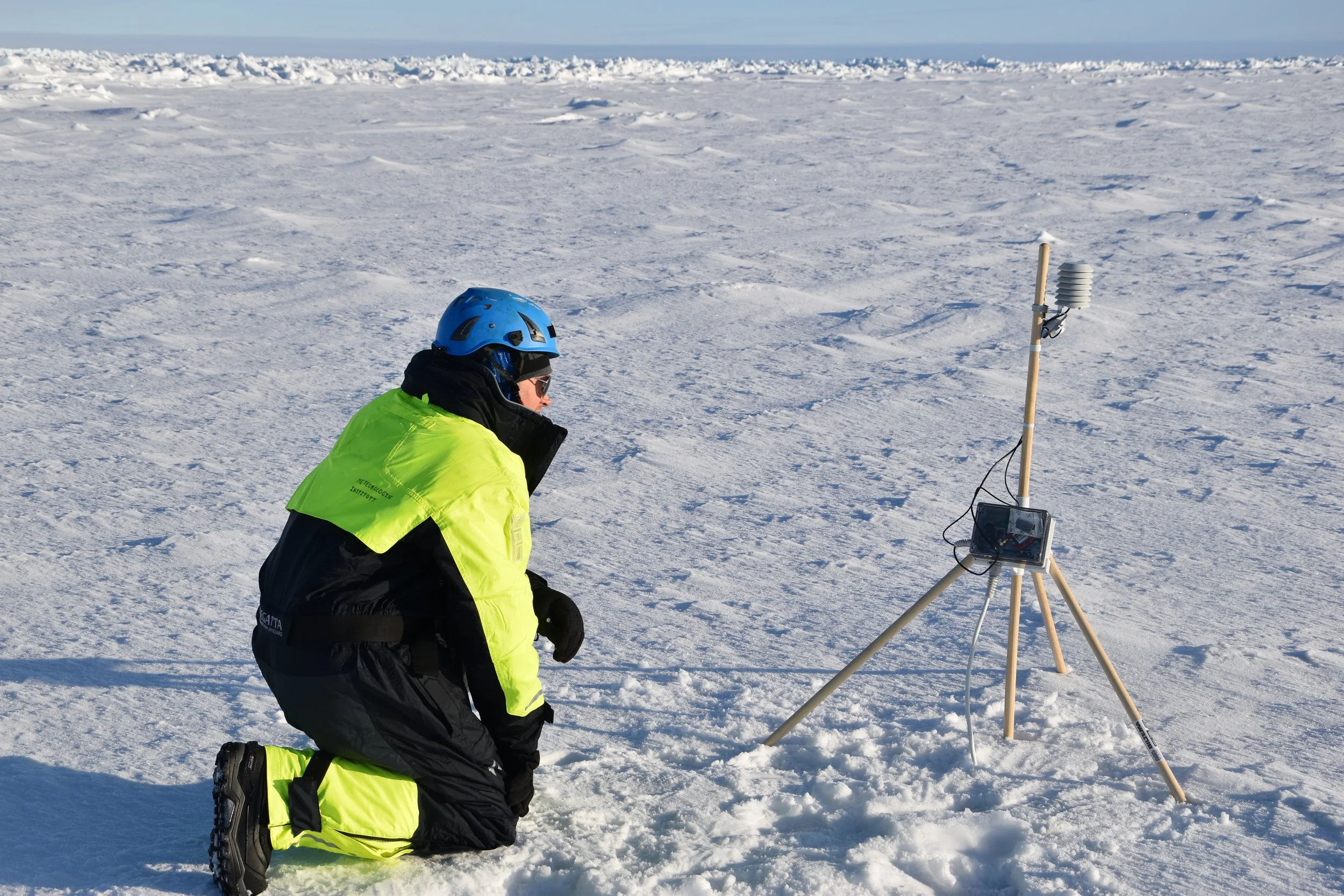
Jean ensuring that a newly deployed buoy is sending data. Photo credit: Malte Müller
During our stay aboard KV Svalbard, we had several insightful discussions with the crew who navigate in the ice. Researchers and end-user usually approach and interpret data differently. However, when it comes to product dissemination, it is the role of the researcher to facilitate that information is conveyed according to user needs. Regarding tactically navigating the ice, whereas most vessels around Svalbard utilize sea ice forecasts in order to actively avoid encountering sea ice, KV Svalbard navigate inside the ice. Thus, KV Svalbard require information about sea ice structure, thickness and floe size distribution, not only a sea ice extent contour which at the moment is currently provided. We believe that what we learned from discussing with and observing the crew in action during tactical ice navigation have given us key insights into developing and providing operationally relevant, end-user focused sea ice data.
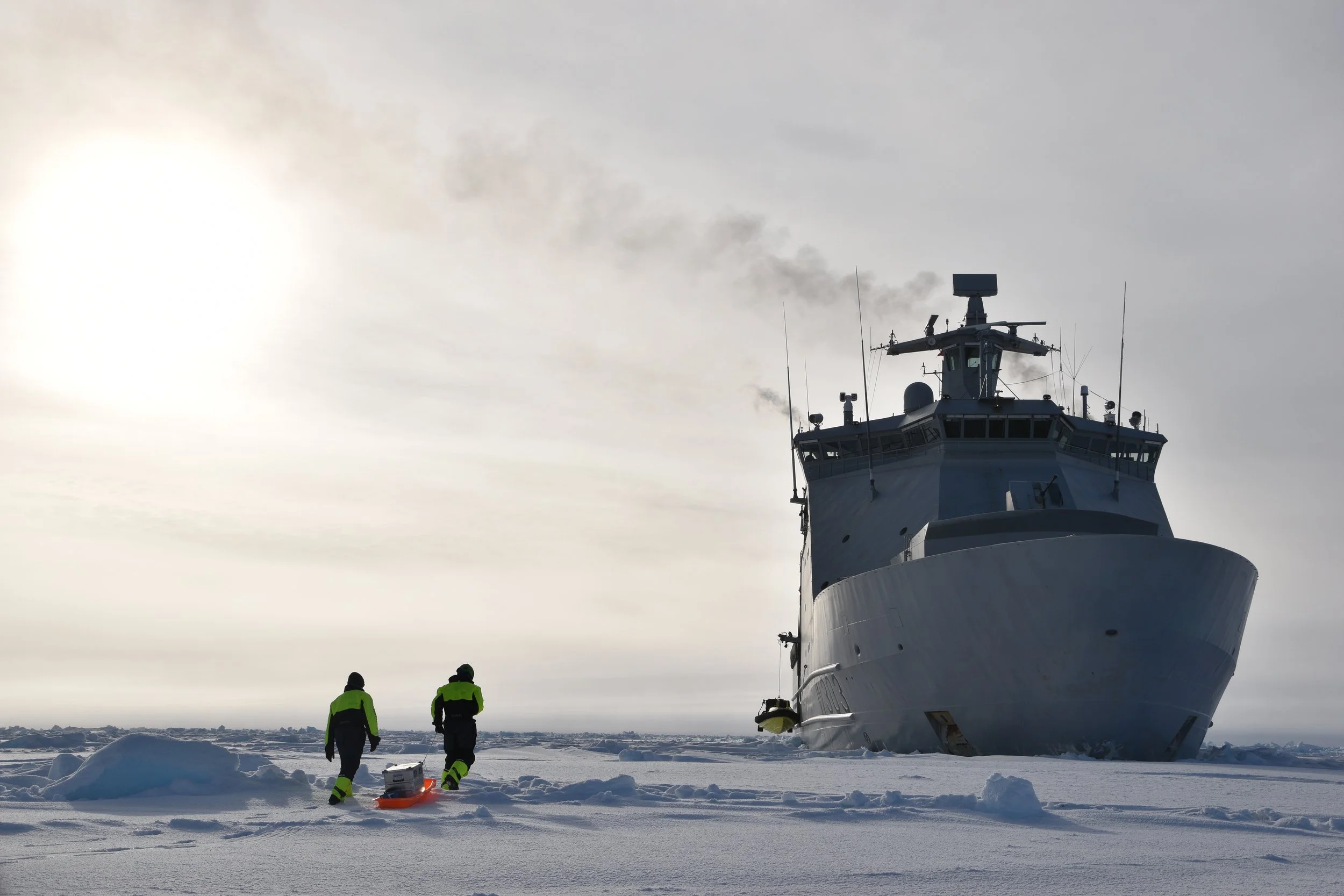
On our way back to the ship after a successful buoy deployment. The cloud conditions were very representative for most of the campaign. Photo credit: Malte Müller
As researchers mostly working with standard datasets, conducting a field campaign on the sea ice presented a nice opportunity to bridge the relationship between in-situ measurements and consistent- and curated datasets. The buoys themselves have several failure modes, ranging from faulty sensors to acts of vandalism performed by polar bears. Additional work is also needed to prepare the data to a cf-compliant, quality insured state. Joining the process from campaign preparation, buoy-deployment and data validation have provided us with perspectives of what goes into ready to use data following standard conventions.
The SvalMIZ26 campaign has provided us with an opportunity to reflect upon the gap between sea ice data as it is collected and as it is used. Additionally, end-users are not a secondary consideration, rather understanding their needs is central to provide useful prediction services. Back on land, we have returned with newfound insights on how to bring our experience from the field into Arctic forecasting, and vice-versa.