

Citizen snow samples help improve hydrological predictions in Scandinavia
Regular citizens collected hundreds of snow samples from across Norway, Sweden, and Finland. Scientists now analyse the samples for their water isotope content in the lab. First results show that citizen science helps scientists to close data gaps, and triggers participants' curiosity and desire to learn more about the science. In the interdisciplinary ISOSCAN project, meteorologists, hydrologists and anthropologists work together utilize data from citizen scientists to improve prediction models. Projects like ISOSCAN help support PCAPS' ambitions for increased observations and community engagement.
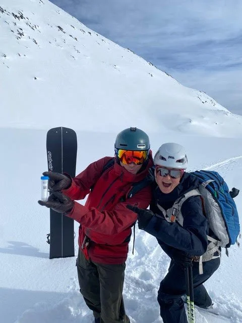
Snow collection during a ski tour on Middagstinden, Kvaløya, northern Norway. Photo credit: Costijn Zwart
Every year, thousands of Scandinavians travel from where they live to the mountains to enjoy the snow on skis or otherwise. What people rarely think about, is that the snow under their feet contains valuable information on how the water travelled from the oceans to the mountains, and how it returns to the coast. To get this information, scientist just need to bring a small sample of the snow in an airtight container back to the laboratory to take some measurements.
In fact, taking this sample is so easy that anyone can do it. What is harder is to go to all the places. This is where scientists in the ISOSCAN project, a collaboration between meteorologists, hydrologists, glaciologists and anthropologists at the University of Bergen and University of Tromsø in Norway, Uppsala University and SMHI in Sweden, University of Oulu in Finland and South Denmark University in Denmark, had the idea to involve citizens in sample collection.
Using co-design methods, ISOSCAN scientists developped a sample kit that is attractive, easy to use, and keeps sample material safe until analysed. Crucial steps were to collect metadata from a web application, and to have participants return the sample when they return home from their trip. To establish a feedback channel to participants, an informative website was set up, including more detailed information, a newsletter, and maps and tables with individual sample results.
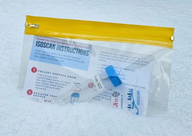
Sampling kit for surface snow samples developed within the ISOSCAN project. Photo credit: Costijn Zwart.
How the science works
As clouds shed more and more water while moving further inland, the number of heavy water molecules gets smaller and smaller. Scientists interpret this signal in two ways. First, in terms of how efficiently clouds produce precipitation, and how much snow has been deposited on the ground. Second, they use the information in the snow to distinguish between river runoff that comes from high up in the mountains from such that comes from closer to the coast. This latter information is highly valuable to improve prediction models for river runoff, such that they provide the right answer for the right reason.
Project results thus far
The project scientists see now hundreds of samples pouring in from all over Scandinavia, ready for analysis. Interactions with participants show that their participation in the sampling raises many questions, and triggers their curiosity. Did I do everything right? What will happen to my sample? Was my sample useful? How will my sample help the science? In the last year of the ISOSCAN project, we have the opportunity of involving the public further into the scientific process by producing a short documentary movie, and a public webinar to present the results from the sample analysis.
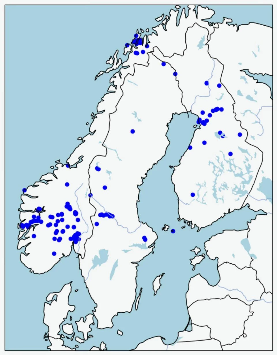
The dots on this map show the locations where surface snow samples were collected by ISOSCAN citizen science samplers during winter 2026. The samples have now arrived at the laboratory in Bergen and will be analysed for their water isotope composition.
For more information about the ongoing sample collection in 2026, visit the ISOSCAN project website. Don’t forget to also check out the first results from 2025!