

Closing the gap: A new ocean-atmosphere observing system for Svalbard's changing climate
The Isfjorden Weather and Ocean Observing System (IWOOS) is a collaborative project dedicated to establishing a multi-platform environmental monitoring system in the rapidly warming Isfjorden region of Svalbard, Norway. Led by PI Marius O. Jonassen at the University Centre in Svalbard (UNIS), the project involves key partners from the Norwegian Meteorological Institute (MET Norway) and the University of Helsinki. IWOOS is funded by the Svalbard Integrated Arctic Earth Observing System (SIOS) and supports PCAPS' goals by improving the accuracy and utility of Arctic environmental forecasts, providing critical data for safer operations in a rapidly changing region.
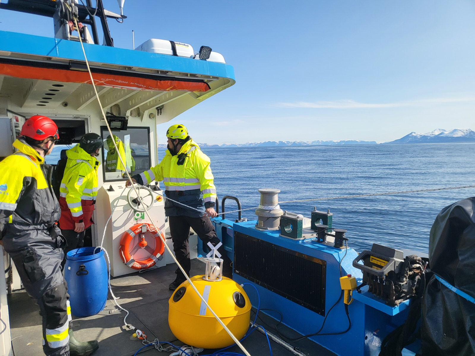
Deployment of an IWOOS mooring close to the northern coastline of Isfjorden, Svalbard. Photo credit: Malte Müller
IWOOS builds upon the existing Isfjorden Weather Information Network (IWIN) by expanding its observational capabilities. IWOOS includes the deployment of five new ocean moorings, equipped to measure surface waves, upper-ocean temperature profiles, and at deeper levels, salinity and pressure. These are based on the open source, low cost OpenMetBuoy (OMB) designs produced by project members Jean Rabault and Malte Müller at MET Norway. Additionally, IWOOS will add new infrared sensors to existing IWIN lighthouse and ship stations to capture terrestrial and sea surface temperatures.
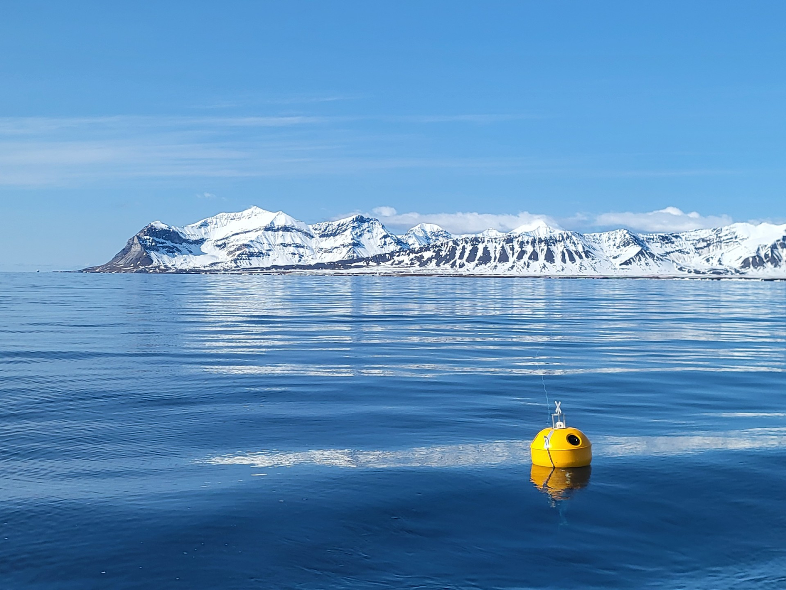
An IWOOS mooring, developed based on the OpenMetBuoy (OMB) open source design, deployed close to the northern coastline of Isfjorden, Svalbard. Photo credit: Malte Müller
This comprehensive system will provide critical SIOS Core Data to fill a significant observational gap in this climate-sensitive area. The data will eventually be made available in near-real-time via MET Norway's data portals and thereby be integrated in the SIOS Data Management System. The data will thus be openly accessible and adhere to FAIR principles (Findable, Accessible, Interoperable, Reusable). Wave and temperature data from the moorings can be accessed in real time at this link.
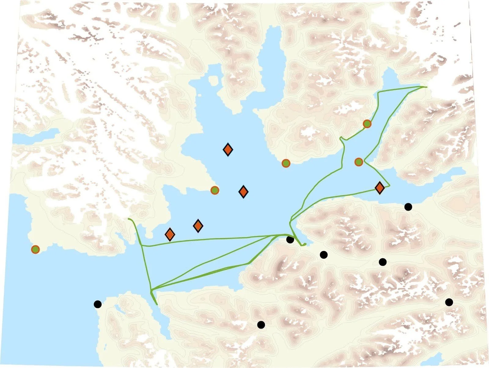
Map of the Isfjorden area showing the locations of existing weather stations from MET Norway (black dots), typical trajectories of ships with IWIN weather stations on them (solid, green lines), lighthouses with IWIN weather stations on them where infrared surface temperature sensors will be installed as part of the IWOOS project (green dots with red circles), as well as locations for new IWOOS ocean moorings (red diamonds).
The IWOOS project directly supports the goals of the World Meteorological Organization's Polar Coupled Analysis and Prediction for Services (PCAPS) project. PCAPS aims to improve the "actionability, impact, and fidelity of environmental forecasting" in polar regions. By collecting high-resolution, near-real-time atmospheric and ocean data, IWOOS will enable the validation and refinement of operational weather and ocean models, which are crucial for generating accurate forecasts. The data will also be used to cross-validate satellite observations, enhancing the overall quality of environmental monitoring. Ultimately, this leads to better, more reliable forecasts that can be used for risk assessment, decision-making, and improved safety for the many human activities, such as tourism and scientific fieldwork, in the harsh, changing Arctic environment